Hiking, cycling, e-biking: our selection of "D+" challenges to spice up your summer!
One day, Santa brought you a smart watch. And ever since, you can’t help but check your performances every time you go on a sports outing! We understand, it’s so tempting. So, here are a few hike/bike/e-bike ideas to help you reach the positive elevation gain that you’re aiming for this summer… You can do your digital detox another time!
Warm up your thighs on a road bike
- Option “machine! From Tignes 2100, head for Tignes 1800, then cross the dam and turn right towards Val d’Isère (lighting is essential for safety in the tunnels). The warm-up continues downhill to the Pont Saint Charles bridge. From here, start climbing the Col de l’Iseran (Europe’s highest road pass!). Haven’t had enough? Head back down the Maurienne side to Bonneval-sur-Arc (listed as one of France’s “Most Beautiful Villages”)… and up again to the Col de l’Iseran for a nice double! Return to Tignes by the same route. On the clock: 1275 m of D+ (or 2230 m of D+ if you go down to Bonneval).
- For the “we’re not here to suffer” option, we recommend the ascent of Tignes, between Les Brévières (1550 m) and Val Claret (2100 m). A more affordable challenge, but one that will no less sting the thighs of Little Queen enthusiasts who have only recently taken up the sport. On the clock: 540 m of D+.
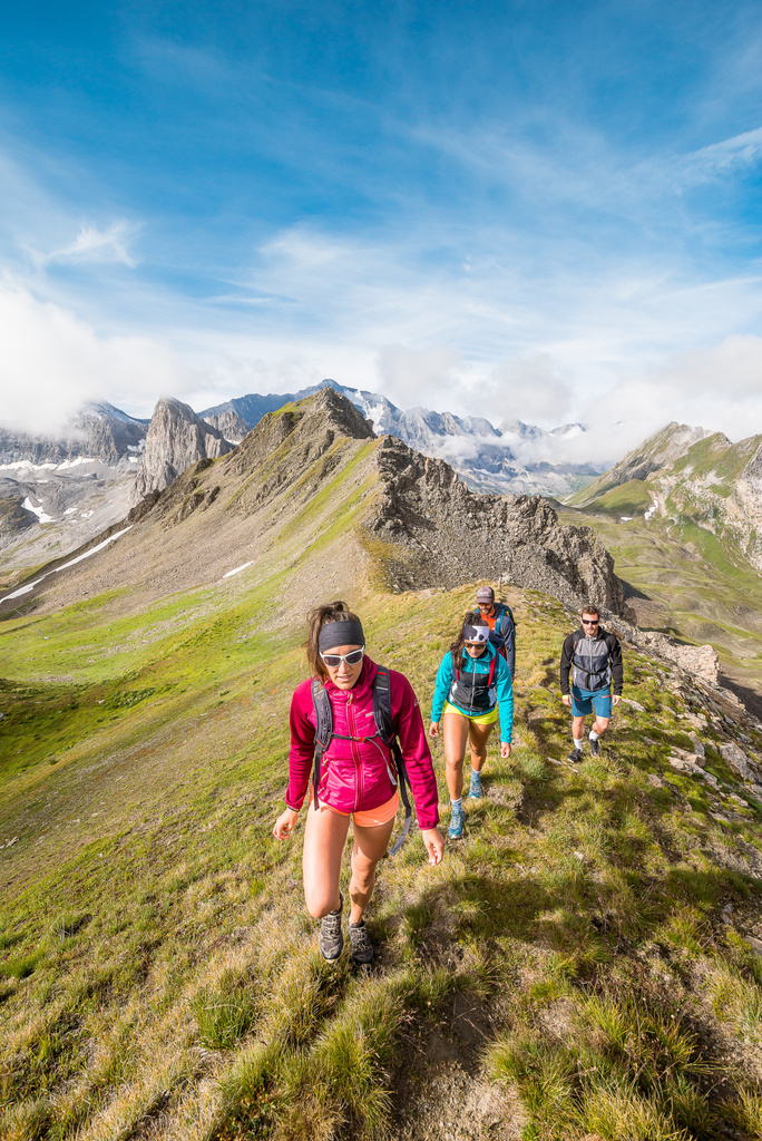
Europe’s highest hike
That’s all there is to it!
Start your ascent on the grassy slopes above the Saut parking lot (above the hamlet of Franchet), before moving into a more mineral world as you approach the long ridge that leads to the Grande Sassière needle. Keep your ears open and your eyes wide open: you may hear chamois or ibex hopping up and down the rocky (but very steep!) slopes to your right. The last part of your climb through the scree will be a mental and cardio challenge. A word of advice: don’t look up, just put one foot in front of the other and let the view dazzle you at the finish! From the platform at an altitude of 3,747 metres, you can enjoy a breathtaking 360° panorama of the French, Italian and Swiss mountains. On the clock: 1,465 meters of D+.
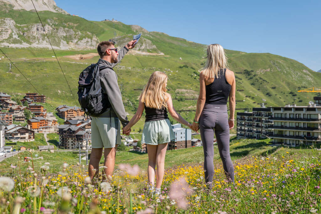
Alternatively, for a more accessible 360° view, climb up to the Aiguille Percée viewpoint indicator, certainly one of Tignes’ most photographed geological phenomena in summer and winter alike. From up there, admire the Grande Motte, Grande Casse, Grande Sassière, Lac du Chevril, La Sache and the hanging glacier… Simply superb! Total climb: 610 m D+ (start: Tignes le Lac).
More information
The Aiguille Percée is on both the 27 km and 44 km Tignes trail routes! An extra challenge if you’re feeling hot after your scouting hike…
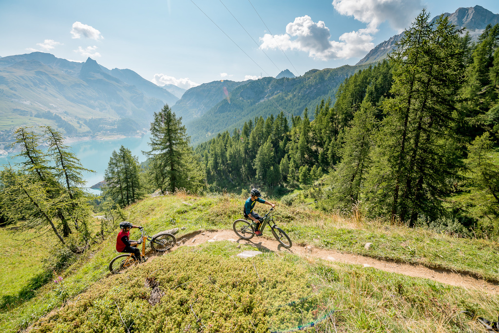
From Tignes le Lac, follow the Chardon’Up electric mountain bike trail (red / advanced level) to the finish of the Tichot chairlift. Turn left and follow the signs for the “Dark Jadore” trail (black/expert level) to the Col du Palet. Take the opportunity to have a look at the other side: you’re at the gateway to the Vanoise National Park! Now it’s time to head back down to the Chardonnet lakes (obligatory photo break), then on to Tignes le Lac via the Chardon’Up and Smoothie (beginner-level downhill slopes). On the clock: 630 meters of D+.
Prefer a more accessible challenge to share with the whole family? Still starting from Tignes le Lac, follow the Cow Lanta trail (blue / initiated level). It will take you all the way to #TIGNES with a breathtaking view of Lac du Chevril. Share your photos on Instagram with #tignes and @tignesofficiel: they may be re-shared by the community manager! On the counter: 320 m of D+.
Tips that make all the difference
- It’s often chilly at altitude! Take something to cover up with (especially at the top of the Col de l’Iseran or the summit of Grande Sassière, where a hat and gloves can be useful even in the middle of August).
- Don’t be overzealous about the weight of your pack: don’t skimp on water and essential snacks (cereal bars, fruit pastes, etc.). It would be a shame to run out of energy in the middle of a climb!
- Go together (or tell a friend about your itinerary)
- Be reasonable. Always remember that the hunt for D+ is a game! Not in shape that day? Turn back and try again later rather than risk injury (or a blow to morale). Strava will still be there tomorrow ????
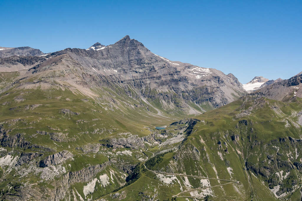
The Aiguille de la Grande Sassière hike
4 unbeatable techniques to get your kids to love hiking
5 great tips for your next hike